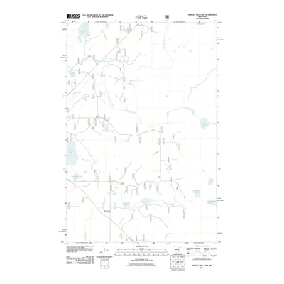
2011 Map of Shingle Mill Lake
USGS Topo · Published 2011About this map
Willow River Dam controls the flow within this water-rich pocket of the Northwoods, where drainage systems like Foley Brook and McCackron Brook feed into a complex network of glacial basins. The landscape is defined by its numerous named lakes, ranging from the central Thiebault Lake and Sailor Lake to the more uniquely named Holy Water Lake in the southeast.
Find a feature on this map
25 named features on this map. Tap any name to fly to it.
Don’t see what you’re looking for? This feature index may not catch every label — zoom into the map to look around manually.
Map Details
Editions of this 2011 Shingle Mill Lake Map
This is the sole edition of this map. No revisions or reprints were ever made.
Other maps of this area

1953 · Siseebakwet Lake
USGS Topo · 1:24,000

1953 · Duluth
USGS Topo · 1:250,000

1954 · Hibbing
USGS Topo · 1:250,000

1957 · Hibbing
USGS Topo · 1:250,000

1958 · Hibbing
USGS Topo · 1:250,000

1958 · Duluth
USGS Topo · 1:250,000

1964 · Hibbing
USGS Topo · 1:250,000

1970 · Big Thunder Peak
USGS Topo · 1:24,000

1970 · Shovel Lake
USGS Topo · 1:24,000
1970 · Thunder Lake
USGS Topo · 1:24,000