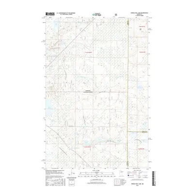
2016 Map of Shingle Mill Lake
USGS Topo · Published 2016About this map
Chippewa National Forest defines the character of this northern Minnesota landscape, where a dense network of water bodies and recreational trails converges at the meeting point of Itasca, Cass, and Aitkin counties. The hydrography of the region is notably modified, with several managed water levels indicated by the Willow River Reservoir, Birch Lake Impoundment, and Loon Lake Impoundment. These features, alongside natural basins like Shingle Mill Lake and Thiebault Lake, illustrate the complex drainage patterns of the N Fork Willow River and its various tributaries. Land use is oriented toward wilderness access, highlighted by the passage of the N Country National Scenic Trail and the Soo Line Gia Snowmobile Trail. Elevated terrain features such as the Sugar Hills rise above the wetlands, providing a diverse topography for those studying the natural history or timber-industry boundaries of the North Woods.
Find a feature on this map
39 named features on this map. Tap any name to fly to it.
Don’t see what you’re looking for? This feature index may not catch every label — zoom into the map to look around manually.
Map Details
Editions of this 2016 Shingle Mill Lake Map
This is the sole edition of this map. No revisions or reprints were ever made.
Other maps of this area

1953 · Siseebakwet Lake
USGS Topo · 1:24,000

1953 · Duluth
USGS Topo · 1:250,000

1954 · Hibbing
USGS Topo · 1:250,000

1957 · Hibbing
USGS Topo · 1:250,000

1958 · Hibbing
USGS Topo · 1:250,000

1958 · Duluth
USGS Topo · 1:250,000

1964 · Hibbing
USGS Topo · 1:250,000

1970 · Big Thunder Peak
USGS Topo · 1:24,000

1970 · Shovel Lake
USGS Topo · 1:24,000
1970 · Thunder Lake
USGS Topo · 1:24,000