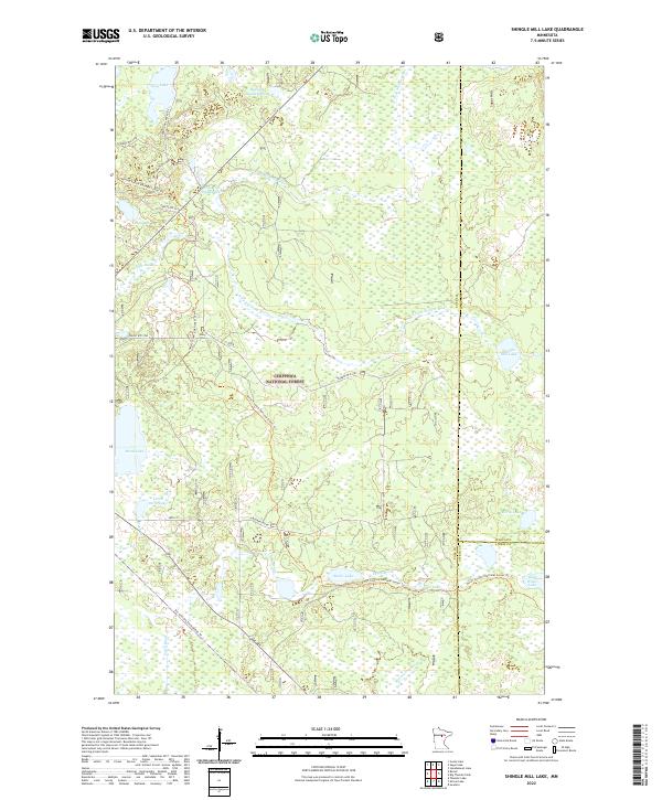
2022 Map of Shingle Mill Lake
USGS Topo · Published 2022About this map
The Chippewa National Forest dominates this northern Minnesota landscape at the junction of Cass, Itasca, and Aitkin Counties. This terrain is defined by a dense network of glacial lakes and waterways, including the winding Willow River and its multiple forks, alongside prominent features like the Sugar Hills to the northeast. Human passage through this wooded area is marked by a mix of specialized recreation routes, from the long-distance North Country National Scenic Trl to the Soo Line Gtw Snowmobile Trl, which follows a former rail corridor. Managed water levels are evident at the Pine Tree Impoundment and Hiway 6 Impoundment, reflecting local efforts to maintain these wetlands. Smaller named bodies of water like Holy Water Lake, Finn Lake, and Shingle Mill Lake provide specific landmarks for those researching the rural geography of this lake-rich region.
Find a feature on this map
36 named features on this map. Tap any name to fly to it.
Don’t see what you’re looking for? This feature index may not catch every label — zoom into the map to look around manually.
Map Details
Editions of this 2022 Shingle Mill Lake Map
This is the sole edition of this map. No revisions or reprints were ever made.
Other maps of this area

1953 · Siseebakwet Lake
USGS Topo · 1:24,000

1953 · Duluth
USGS Topo · 1:250,000

1954 · Hibbing
USGS Topo · 1:250,000

1957 · Hibbing
USGS Topo · 1:250,000

1958 · Hibbing
USGS Topo · 1:250,000

1958 · Duluth
USGS Topo · 1:250,000

1964 · Hibbing
USGS Topo · 1:250,000

1970 · Big Thunder Peak
USGS Topo · 1:24,000

1970 · Shovel Lake
USGS Topo · 1:24,000
1970 · Thunder Lake
USGS Topo · 1:24,000