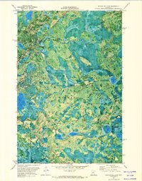
1971 Map of Shingle Mill Lake
USGS Topo · Published 1974About this map
The Remer State Forest and Chippewa National Forest converge in this orthophotomap, showing a dense mosaic of peatlands and timber at the onset of the 1970s. The landscape is defined by its complex hydrography, where the North Fork and South Fork of the Willow River wind through a series of kettle lakes and glacial depressions. Cultural signatures are sparse but telling, dominated by the diagonal corridor of the Soo Line railroad which cuts through the forest northwest of Hill River State Forest. This orthophoto format provides a clear view of vegetation patterns and wetland boundaries often obscured on traditional line maps, specifically around the isolated basins of Holy Water Lake and Shingle Mill Lake. A single Gravel Pit near the river indicates localized resource extraction in an otherwise largely undeveloped timber and wilderness area.
Find a feature on this map
23 named features on this map. Tap any name to fly to it.
Don’t see what you’re looking for? This feature index may not catch every label — zoom into the map to look around manually.
Map Details
Editions of this 1971 Shingle Mill Lake Map
This is the sole edition of this map. No revisions or reprints were ever made.
Other maps of this area

1953 · Siseebakwet Lake
USGS Topo · 1:24,000

1953 · Duluth
USGS Topo · 1:250,000

1954 · Hibbing
USGS Topo · 1:250,000

1957 · Hibbing
USGS Topo · 1:250,000

1958 · Hibbing
USGS Topo · 1:250,000

1958 · Duluth
USGS Topo · 1:250,000

1964 · Hibbing
USGS Topo · 1:250,000

1970 · Big Thunder Peak
USGS Topo · 1:24,000

1970 · Shovel Lake
USGS Topo · 1:24,000
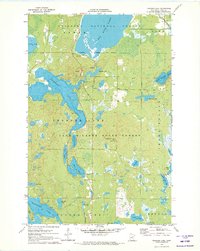
1970 · Thunder Lake
USGS Topo · 1:24,000