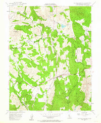
1949 Map of Shingle Springs
USGS Topo · Published 1963About this map
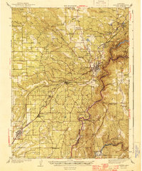
Shingle Springs and the surrounding El Dorado County foothills are defined by a complex network of mining operations and small agrarian settlements in this mid-century period. The landscape is marked by numerous active and historical extraction sites, including the Pyramid Mine, Funny Bug Mine, and the Greenstone Mine, reflecting the region's enduring mineral economy. The Shingle Springs Indian Reservation occupies a significant tract east of Dry Creek, while the Southern Pacific railroad corridor serves as the primary industrial artery connecting the foothills to the valley. Cultural landmarks like the Jayhawk Cem and local schoolhouses such as Tennessee School and Deer Valley School anchor the small, scattered communities. This 1940s topography captures the area as it transitioned from its deep mining roots toward modern rural development, with places like Frenchtown and White Oak Flat still clearly defined against the rising elevations of Pine Hill.
Find a feature on this map
40 named features on this map. Tap any name to fly to it.
Don’t see what you’re looking for? This feature index may not catch every label — zoom into the map to look around manually.
Map Details
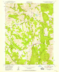
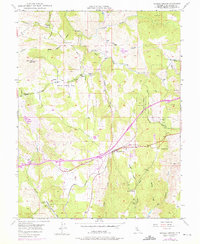
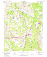
Editions of this 1949 Shingle Springs Map
4 editions found
Other maps of this area

1891 · Sacramento
USGS Topo · 1:125,000

1891 · Placerville
USGS Topo · 1:125,000

1892 · Sacramento
USGS Topo · 1:125,000

1892 · Placerville
USGS Topo · 1:125,000

1893 · Placerville
USGS Topo · 1:125,000

1893 · Sacramento
USGS Topo · 1:125,000

1941 · Folsom
USGS Topo · 1:62,500
1944 · Auburn
USGS Topo · 1:62,500

1944 · Folsom
USGS Topo · 1:62,500

1947 · Sacramento
USGS Topo · 1:250,000