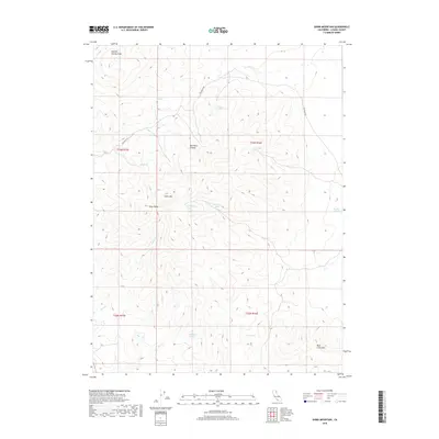
2018 Map of Shinn Mountain
USGS Topo · Published 2018About this map
Shinn Mtn and the adjacent Shinn Peaks dominate this high-desert landscape in northeastern California, where survival and movement are historically tied to a network of isolated water sources. Named springs such as Juniper Jim Spring, Toms Cabin Spring, and Bills Cabin Spring suggest a legacy of early ranching and seasonal grazing camps. These points of water, along with the Summit Troughs near the northern boundary, were essential for sustaining livestock and travelers navigating the area. The map illustrates a remote terrain defined by significant elevation changes, from the depths of Rye Patch Canyon to the heights of Rush Creek Mtn. Transportation is limited to primitive routes like Rye Patch Rd, reflecting the enduringly sparse development of this portion of Lassen County.
Find a feature on this map
20 named features on this map. Tap any name to fly to it.
Don’t see what you’re looking for? This feature index may not catch every label — zoom into the map to look around manually.
Map Details
Editions of this 2018 Shinn Mountain Map
This is the sole edition of this map. No revisions or reprints were ever made.
Other maps of this area

1886 · Honey Lake
USGS Topo · 1:250,000

1891 · Honey Lake
USGS Topo · 1:250,000

1893 · Honey Lake
USGS Topo · 1:250,000

1954 · Observation Peak
USGS Topo · 1:62,500

1954 · Karlo
USGS Topo · 1:62,500

1954 · Ravendale
USGS Topo · 1:62,500

1954 · Shinn Mountain
USGS Topo · 1:62,500

1955 · Westwood
USGS Topo · 1:250,000

1958 · Westwood
USGS Topo · 1:250,000

1959 · Westwood
USGS Topo · 1:250,000