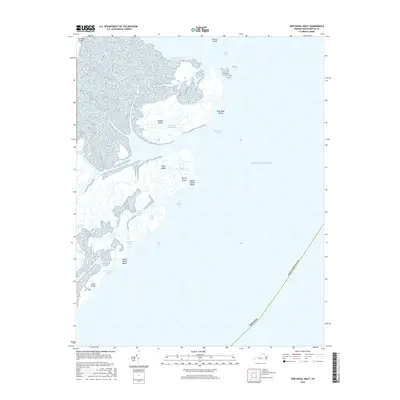
2016 Map of Ship Shoal Inlet
USGS Topo · Published 2016About this map
Smith Island and a sprawling chain of barrier islands dominate this coastal portion of Northampton County, Virginia. The landscape is a complex network of marshes and tidal waterways, where major passages like the Main-Ship Shoal Channel and White Perch Channel provide navigation through the shifting shoals. This 2016 survey highlights the dynamic nature of the Atlantic coastline, showing the reach of Ship Shoal Inlet and New Inlet as they divide the protective outer banks.
Find a feature on this map
27 named features on this map. Tap any name to fly to it.
Don’t see what you’re looking for? This feature index may not catch every label — zoom into the map to look around manually.
Map Details
Editions of this 2016 Ship Shoal Inlet Map
This is the sole edition of this map. No revisions or reprints were ever made.
Other maps of this area

1941 · Broadwater
USGS Topo · 1:62,500

1942 · Cheriton
USGS Topo · 1:24,000

1942 · Cobb Island
USGS Topo · 1:24,000

1942 · Great Machipongo Inlet
USGS Topo · 1:24,000

1943 · Townsend
USGS Topo · 1:24,000

1946 · Eastville
USGS Topo · 1:250,000
1953 · Ship Shoal Inlet
USGS Topo · 1:24,000
1955 · Cheriton
USGS Topo · 1:24,000
1955 · Townsend
USGS Topo · 1:24,000

1961 · Eastville
USGS Topo · 1:250,000