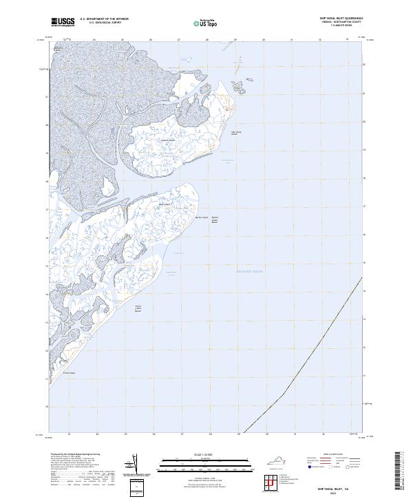
2022 Map of Ship Shoal Inlet
USGS Topo · Published 2022About this map
Godwin Island and Ship Shoal Island sit at the center of this intricate coastal survey, where the dynamic barrier island system of the Eastern Shore meets the Atlantic Ocean. The landscape is dominated by tidal marshes and winding waterways such as Big Creek Marsh and Red Drum Drain. Navigation through these shifting shoals relies on named passages like the Main Ship Shoal Channel and White Channel, which weave between Mink Island and the mainland. Historically significant landforms including Smith Island and Myrtle Island Beach provide a record of the shoreline's composition, where inlets like Bungalow Inlet and Little Inlet continuously reshape the reach of the tide against the Virginia coast.
Find a feature on this map
26 named features on this map. Tap any name to fly to it.
Don’t see what you’re looking for? This feature index may not catch every label — zoom into the map to look around manually.
Map Details
Editions of this 2022 Ship Shoal Inlet Map
This is the sole edition of this map. No revisions or reprints were ever made.
Other maps of this area

1941 · Broadwater
USGS Topo · 1:62,500

1942 · Cheriton
USGS Topo · 1:24,000

1942 · Cobb Island
USGS Topo · 1:24,000

1942 · Great Machipongo Inlet
USGS Topo · 1:24,000

1943 · Townsend
USGS Topo · 1:24,000

1946 · Eastville
USGS Topo · 1:250,000
1953 · Ship Shoal Inlet
USGS Topo · 1:24,000
1955 · Cheriton
USGS Topo · 1:24,000
1955 · Townsend
USGS Topo · 1:24,000

1961 · Eastville
USGS Topo · 1:250,000