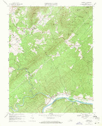
1969 Map of Shipman
USGS Topo · Published 1971About this map
The James River defines the southern boundary of this Nelson County landscape, where it meets the confluence of the Tye River and Buffalo Creek near the town of Norwood. This area showcases a transitional terrain where ridges like Findlay Mountain and Turner Mountain rise above small river valleys. Two major rail corridors anchor the local economy and geography: the Chesapeake And Ohio Railway following the riverbank, and the Southern Railway cutting through the interior near the village of Shipman.
Find a feature on this map
53 named features on this map. Tap any name to fly to it.
Don’t see what you’re looking for? This feature index may not catch every label — zoom into the map to look around manually.
Map Details
Editions of this 1969 Shipman Map
4 editions found
Other maps of this area

1892 · Buckingham
USGS Topo · 1:125,000

1929 · Covesville
USGS Topo · 1:62,500

1935 · Covesville
USGS Topo · 1:62,500

1943 · Lovingston
USGS Topo · 1:62,500

1945 · Covesville
USGS Topo · 1:62,500

1946 · Lovingston
USGS Topo · 1:62,500

1947 · Roanoke
USGS Topo · 1:250,000

1959 · Roanoke
USGS Topo · 1:250,000

1961 · Shipman
USGS Topo · 1:62,500

1961 · Buckingham
USGS Topo · 1:62,500