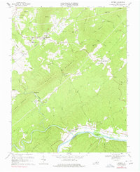
1969 Map of Shipman
USGS Topo · Published 1977About this map
Shipman stands at the center of this 1969 topographic survey, situated where the Southern railroad tracks wind through the foothills of the Blue Ridge. The landscape is defined by the convergence of major waterways, including the Tye River and Buffalo River as they flow toward their junction with the James River at Norwood. This river-and-rail corridor supported a network of rural communities, illustrated by the presence of Variety Mills and the Ryan Hall School nearby.
Find a feature on this map
59 named features on this map. Tap any name to fly to it.
Don’t see what you’re looking for? This feature index may not catch every label — zoom into the map to look around manually.
Map Details
Editions of this 1969 Shipman Map
4 editions found
Other maps of this area

1892 · Buckingham
USGS Topo · 1:125,000

1929 · Covesville
USGS Topo · 1:62,500

1935 · Covesville
USGS Topo · 1:62,500

1943 · Lovingston
USGS Topo · 1:62,500

1945 · Covesville
USGS Topo · 1:62,500

1946 · Lovingston
USGS Topo · 1:62,500

1947 · Roanoke
USGS Topo · 1:250,000

1959 · Roanoke
USGS Topo · 1:250,000

1961 · Shipman
USGS Topo · 1:62,500

1961 · Buckingham
USGS Topo · 1:62,500