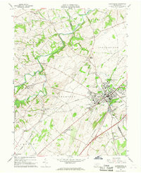
1966 Map of Shippensburg
USGS Topo · Published 1968About this map
The Shippensburg State College campus serves as a central landmark for this mid-1960s survey of the Cumberland Valley, where the academic grounds meet the bustling rail intersections of the Penn Central and Reading lines. The landscape is a mix of agricultural fields and small villages, with many rural crossroads anchored by landmarks like St Pauls Ch and Rowe Ch. The meandering Conodoguinet Creek defines the northern topography, while to the south, the industrial influence of quarries and shale pits near Pinola and the Maryland Western Railroad corridor is evident. Local history is etched into the terrain at sites like Spring Hill Cemetery and the Fairgrounds, reflecting a community where established educational institutions and traditional rail transport supported the local economy. From the village of Orrstown to the elevations of Timber Hill, the map captures the transition between town life and the surrounding farm country.
Find a feature on this map
48 named features on this map. Tap any name to fly to it.
Don’t see what you’re looking for? This feature index may not catch every label — zoom into the map to look around manually.
Map Details
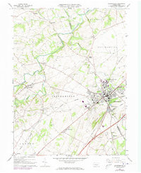
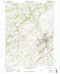
Editions of this 1966 Shippensburg Map
Other maps of this area

1902 · Chambersburg
USGS Topo · 1:62,500

1909 · Fairfield
USGS Topo · 1:62,500

1919 · Newville
USGS Topo · 1:62,500

1923 · Shippensburg
USGS Topo · 1:62,500

1942 · Hagerstown
USGS Topo · 1:125,000

1942 · Gettysburg
USGS Topo · 1:125,000

1943 · Hagerstown
USGS Topo · 1:125,000

1943 · Chambersburg
USGS Topo · 1:62,500

1943 · Shippensburg
USGS Topo · 1:62,500

1944 · Scotland
USGS Topo · 1:31,680