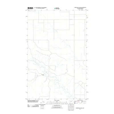
2011 Map of Shipstead Coulee
USGS Topo · Published 2011About this map
West Fork Poplar River meanders across this rural landscape in Daniels County, providing a vital water source for the surrounding high plains. The terrain is defined by the winding course of Shipstead Coulee, which cuts through the region and gives the area its name. This survey illustrates a spare but organized network of rural roads that follow section lines, such as Ferrestad Rd and Police Creek Rd, indicating the persistent ranching and agricultural framework of northeastern Montana. The drainage patterns of Police Creek and Hell Creek emphasize the seasonal water flow that shapes the local geography. Researchers will find a landscape that remains sparsely populated, where the few named landmarks often represent family names or essential geographic markers for navigating the open range.
Find a feature on this map
8 named features on this map. Tap any name to fly to it.
Don’t see what you’re looking for? This feature index may not catch every label — zoom into the map to look around manually.
Map Details
Editions of this 2011 Shipstead Coulee Map
This is the sole edition of this map. No revisions or reprints were ever made.
Other maps of this area

1954 · Wolf Point
USGS Topo · 1:250,000

1958 · Wolf Point
USGS Topo · 1:250,000

1973 · Peerless 4 NE
USGS Topo · 1:24,000

1973 · West Fork NE
USGS Topo · 1:24,000

1973 · Peerless
USGS Topo · 1:24,000

1973 · Killenbeck Reservoir
USGS Topo · 1:24,000

1973 · Peerless 4 SE
USGS Topo · 1:24,000

1973 · Peerless 4 SW
USGS Topo · 1:24,000

1973 · Four Buttes
USGS Topo · 1:24,000

1973 · Poplar Coulee
USGS Topo · 1:24,000