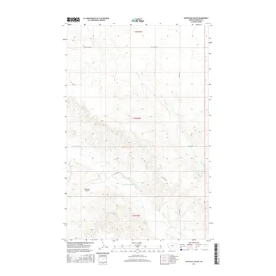
2017 Map of Shipstead Coulee
USGS Topo · Published 2017About this map
W Fork Poplar River meanders through the central and southern reaches of this landscape, carving a distinct valley through the northern plains of Montana. The drainage patterns define the region's topography, with Police Cr flowing in the north and Hell Cr appearing in the southeast. Named for a specific landform, Shipstead Coulee marks the southwestern terrain, where the elevation changes become more pronounced. This 2017 survey reveals a sparse network of section-line roads and named routes that navigate the township and range boundaries. Key transit lines include Police Creek Rd and Wilcoxon Rd, which connect the open sections of the Wolf Point District. The map provides a precise look at the rural infrastructure and natural watercourses that have dictated land use in Roosevelt County for generations.
Find a feature on this map
11 named features on this map. Tap any name to fly to it.
Don’t see what you’re looking for? This feature index may not catch every label — zoom into the map to look around manually.
Map Details
Editions of this 2017 Shipstead Coulee Map
This is the sole edition of this map. No revisions or reprints were ever made.
Other maps of this area

1954 · Wolf Point
USGS Topo · 1:250,000

1958 · Wolf Point
USGS Topo · 1:250,000

1973 · Peerless 4 NE
USGS Topo · 1:24,000

1973 · West Fork NE
USGS Topo · 1:24,000

1973 · Peerless
USGS Topo · 1:24,000

1973 · Killenbeck Reservoir
USGS Topo · 1:24,000

1973 · Peerless 4 SE
USGS Topo · 1:24,000

1973 · Peerless 4 SW
USGS Topo · 1:24,000

1973 · Four Buttes
USGS Topo · 1:24,000

1973 · Poplar Coulee
USGS Topo · 1:24,000