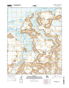
2014 Map of Shishmaref A-2 SE
USGS Topo · Published 2014About this map
Bering Land Bridge National Preserve encompasses a vast portion of this 2014 Alaskan landscape, protecting a wilderness that remains largely unchanged since prehistoric times. The terrain is defined by a complex network of coastal waterways and tundra, where the Arctic River and the meandering Sanaguich River flow toward the tidal reaches of Shishmaref Inlet. To the north, the waters of Kotzebue Sound meet the shoreline, reflecting the remote coastal character of the Seward Peninsula. Small drainages like Bonanza Cr cut through the low-lying topography, illustrating the intricate hydrology of this subarctic environment. The map preserves the modern boundaries of the preserve, highlighting a region where natural processes and traditional land use continue without the infrastructure of permanent roads or settlements.
Find a feature on this map
2 named features on this map. Tap any name to fly to it.
Don’t see what you’re looking for? This feature index may not catch every label — zoom into the map to look around manually.
Map Details
Editions of this 2014 Shishmaref A-2 SE Map
This is the sole edition of this map. No revisions or reprints were ever made.
Other maps of this area

1950 · Teller
USGS Topo · 1:250,000

1950 · Shishmaref
USGS Topo · 1:250,000

1950 · Shishmaref A-1
USGS Topo · 1:63,360

1950 · Teller D-2
USGS Topo · 1:63,360

1950 · Shishmaref A-2
USGS Topo · 1:63,360

1950 · Teller D-1
USGS Topo · 1:63,360

1951 · Shishmaref
USGS Topo · 1:250,000

1951 · Teller
USGS Topo · 1:250,000

1957 · Teller
USGS Topo · 1:250,000

1958 · Teller
USGS Topo · 1:250,000