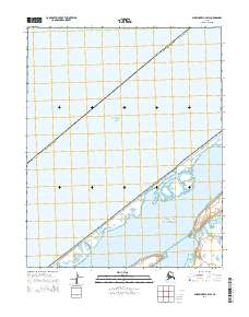
2014 Map of Shishmaref A-4 SW
USGS Topo · Published 2014About this map
The Bering Land Bridge National Preserve dominates this coastal landscape on the Seward Peninsula, protecting a vast stretch of Arctic tundra and maritime ecosystems. The coastline transitions from the open waters of the Chukchi Sea to a complex network of barrier islands and tidal lagoons. Moving inland, the terrain is defined by the Kugrupaga Inlet and the meandering path of Trout Cr, which drains toward the coast. This map illustrates the intersection of federal conservation lands and the administrative boundaries of the Nome Census Area. The absence of developed roads or settlements highlights the remote character of this region, where the natural hydrology and the expansive reach of the national preserve remain the primary features of interest.
Find a feature on this map
10 named features on this map. Tap any name to fly to it.
Don’t see what you’re looking for? This feature index may not catch every label — zoom into the map to look around manually.
Map Details
Editions of this 2014 Shishmaref A-4 SW Map
This is the sole edition of this map. No revisions or reprints were ever made.
Other maps of this area

1950 · Teller
USGS Topo · 1:250,000

1950 · Shishmaref
USGS Topo · 1:250,000

1950 · Teller D-5
USGS Topo · 1:63,360
1950 · Shishmaref A-4
USGS Topo · 1:63,360
1950 · Teller D-4
USGS Topo · 1:63,360

1951 · Shishmaref
USGS Topo · 1:250,000

1951 · Teller
USGS Topo · 1:250,000

1957 · Teller
USGS Topo · 1:250,000

1958 · Teller
USGS Topo · 1:250,000
2014 · Teller D-4 NW
USGS Topo · 1:25,000