
1950 Map of Teller D-5
USGS Topo · Published 1957About this map
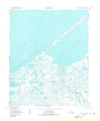
Ikpek stands as a small settlement along the coastline where the Arctic Ocean meets the Seward Peninsula. This 1950s study, based on aerial photography from the Department of the Army, documents a landscape defined by expansive coastal waters and intricate drainage systems. The northern portion of the map is dominated by the Arctic Lagoon, separated from the open sea by a narrow barrier spit that carries the Winter Trail (Approximate Alignment), a vital seasonal transport route in this environment.
Find a feature on this map
8 named features on this map. Tap any name to fly to it.
Don’t see what you’re looking for? This feature index may not catch every label — zoom into the map to look around manually.
Map Details
Editions of this 1950 Teller D-5 Map
2 editions found
Other maps of this area

1950 · Teller
USGS Topo · 1:250,000

1950 · Shishmaref
USGS Topo · 1:250,000

1950 · Teller C-6
USGS Topo · 1:63,360

1950 · Teller C-4
USGS Topo · 1:63,360
1950 · Teller D-6
USGS Topo · 1:63,360
1950 · Shishmaref A-4
USGS Topo · 1:63,360
1950 · Teller D-4
USGS Topo · 1:63,360

1950 · Teller C-5
USGS Topo · 1:63,360

1951 · Shishmaref
USGS Topo · 1:250,000

1951 · Teller
USGS Topo · 1:250,000