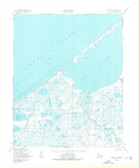
1950 Map of Teller D-5
USGS Topo · Published 1975About this map
Ikpek sits at the edge of the Arctic Ocean, a focal point in a landscape defined by the shallow waters of the Seward Peninsula's northwestern coast. Surveyed through photogrammetric methods in 1950, this map reveals a complex network of coastal lagoons, including Ikpek Lagoon and Lopp Lagoon, separated from the sea by narrow barrier spits. A prominent Winter Trail follows these coastlines, providing a vital transport corridor across the tundra. The interior is a mosaic of small lakes and marshes drained by the Pinguk River and York Creek. A single Tower near the coast indicates one of the few structural landmarks in this remote maritime environment, marking a period when aerial mapping began to fully document the intricacies of the Alaskan shoreline.
Find a feature on this map
8 named features on this map. Tap any name to fly to it.
Don’t see what you’re looking for? This feature index may not catch every label — zoom into the map to look around manually.
Map Details
Editions of this 1950 Teller D-5 Map
2 editions found
Other maps of this area

1950 · Teller
USGS Topo · 1:250,000

1950 · Shishmaref
USGS Topo · 1:250,000

1950 · Teller C-6
USGS Topo · 1:63,360

1950 · Teller D-5
USGS Topo · 1:63,360

1950 · Teller C-4
USGS Topo · 1:63,360
1950 · Teller D-6
USGS Topo · 1:63,360
1950 · Shishmaref A-4
USGS Topo · 1:63,360
1950 · Teller D-4
USGS Topo · 1:63,360

1950 · Teller C-5
USGS Topo · 1:63,360

1951 · Shishmaref
USGS Topo · 1:250,000