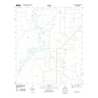
2010 Map of Shoats Creek
USGS Topo · Published 2010About this map
The Sabine River snakes through this corner of Calcasieu Parish, creating a complex geography of oxbows and floodplain landmarks like Dead Lake, Circle Lake, and Horseshoe Lake. Along the eastern bank, the landscape transitions from the river bottoms near Nicks Landing to the upland plains where timber and energy extraction define the local economy. The presence of the North Starks Oil Field and South Bancroft Gas Field highlights the industrial character of the region in the early 21st century.
Find a feature on this map
59 named features on this map. Tap any name to fly to it.
Don’t see what you’re looking for? This feature index may not catch every label — zoom into the map to look around manually.
Map Details
Editions of this 2010 Shoats Creek Map
This is the sole edition of this map. No revisions or reprints were ever made.
Other maps of this area

1947 · Starks
USGS Topo · 1:31,680

1947 · Carter Creek
USGS Topo · 1:31,680

1947 · Hyatt
USGS Topo · 1:31,680

1947 · Lunita
USGS Topo · 1:31,680

1947 · Long Marsh
USGS Topo · 1:31,680

1949 · Bancroft
USGS Topo · 1:31,680

1952 · Lake Charles
USGS Topo · 1:250,000

1954 · Lake Charles
USGS Topo · 1:250,000
1955 · Hyatt
USGS Topo · 1:31,680

1955 · Bessmay
USGS Topo · 1:62,500