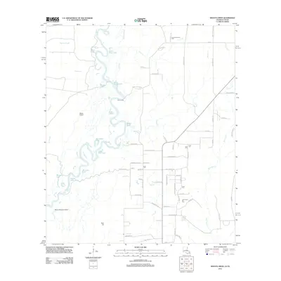
2012 Map of Shoats Creek
USGS Topo · Published 2012About this map
The Sabine River snakes through the western edge of this territory, defining a complex riparian landscape of oxbow lakes and sloughs. Water bodies like Horseshoe Lake, Dead Lake, and Big Eddy Lake indicate the river's historical shifts, while the swampy interior contains curious landmarks like Devils Pocket and Bayou Deception Island. The eastern half of the map reveals a more developed upland pattern, characterized by family-named roads and rural infrastructure.
Find a feature on this map
79 named features on this map. Tap any name to fly to it.
Don’t see what you’re looking for? This feature index may not catch every label — zoom into the map to look around manually.
Map Details
Editions of this 2012 Shoats Creek Map
This is the sole edition of this map. No revisions or reprints were ever made.
Other maps of this area

1947 · Starks
USGS Topo · 1:31,680

1947 · Carter Creek
USGS Topo · 1:31,680

1947 · Hyatt
USGS Topo · 1:31,680

1947 · Lunita
USGS Topo · 1:31,680

1947 · Long Marsh
USGS Topo · 1:31,680

1949 · Bancroft
USGS Topo · 1:31,680

1952 · Lake Charles
USGS Topo · 1:250,000

1954 · Lake Charles
USGS Topo · 1:250,000
1955 · Hyatt
USGS Topo · 1:31,680

1955 · Bessmay
USGS Topo · 1:62,500