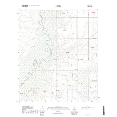
2020 Map of Shoats Creek
USGS Topo · Published 2020About this map
The Sabine River winds through a complex landscape of wetlands and oxbow lakes along the border of Louisiana and Texas. This modern survey captures the intricate hydrology of the region, where features like Devils Pocket and Bayou Deception Island define the low-lying terrain. To the east, the map detail transitions into the timberlands and rural reaches of Calcasieu Parish, showing a network of parish roads and family-named landmarks. The area's local history is anchored by several small burial grounds, including Smith Cem and Carter Cem, which provide valuable points of reference for genealogists. Small settlements such as Babe and High Hill stand as quiet nodes in a landscape primarily shaped by the meandering river and its numerous tributaries, such as Shoats Cr and Slaydons Creek.
Find a feature on this map
80 named features on this map. Tap any name to fly to it.
Don’t see what you’re looking for? This feature index may not catch every label — zoom into the map to look around manually.
Map Details
Editions of this 2020 Shoats Creek Map
This is the sole edition of this map. No revisions or reprints were ever made.
Other maps of this area

1947 · Starks
USGS Topo · 1:31,680

1947 · Carter Creek
USGS Topo · 1:31,680

1947 · Hyatt
USGS Topo · 1:31,680

1947 · Lunita
USGS Topo · 1:31,680

1947 · Long Marsh
USGS Topo · 1:31,680

1949 · Bancroft
USGS Topo · 1:31,680

1952 · Lake Charles
USGS Topo · 1:250,000

1954 · Lake Charles
USGS Topo · 1:250,000
1955 · Hyatt
USGS Topo · 1:31,680

1955 · Bessmay
USGS Topo · 1:62,500