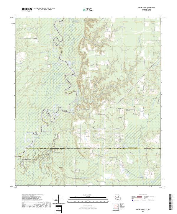
2024 Map of Shoats Creek
USGS Topo · Published 2024About this map
The Sabine River forms a winding natural border between Beauregard Parish, Louisiana, and Newton County, Texas, defining a landscape of wetlands and oxbow lakes. This riparian corridor is marked by numerous named backwaters, including Burnt Stump Lake, Dead Lake, and Circle Lake, alongside the distinctive Devis Pocket. Historically, river crossings like Nicks Ferry provided essential connectivity before the modern road network took shape.
Find a feature on this map
79 named features on this map. Tap any name to fly to it.
Don’t see what you’re looking for? This feature index may not catch every label — zoom into the map to look around manually.
Map Details
Editions of this 2024 Shoats Creek Map
This is the sole edition of this map. No revisions or reprints were ever made.
Other maps of this area

1947 · Starks
USGS Topo · 1:31,680

1947 · Carter Creek
USGS Topo · 1:31,680

1947 · Hyatt
USGS Topo · 1:31,680

1947 · Lunita
USGS Topo · 1:31,680

1947 · Long Marsh
USGS Topo · 1:31,680

1949 · Bancroft
USGS Topo · 1:31,680

1952 · Lake Charles
USGS Topo · 1:250,000

1954 · Lake Charles
USGS Topo · 1:250,000
1955 · Hyatt
USGS Topo · 1:31,680

1955 · Bessmay
USGS Topo · 1:62,500