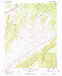
1970 Map of Shonto SE
USGS Topo · Published 1983About this map
Klethla Valley serves as a central corridor for infrastructure and transit across the Navajo Indian Reservation during this era of industrial development. A long straight Railroad and parallel Pipeline cut diagonally across the terrain, supported by a significant Conveyor system and areas marked for Mining. This landscape is one of transition, where the high ground of the Shonto Plateau meets the valley floor, segmented by the Old Indian Reservation Boundary. While human presence is evidenced by a Trailer Park, a Corral, and scattered Water Tanks, much of the area remains accessible only by 4wd tracks and a Pack Trail. Natural drainage is defined by John Smith Wash, which carves through the northern plateau, contrasting with the engineered precision of the industrial corridor to the south.
Find a feature on this map
18 named features on this map. Tap any name to fly to it.
Don’t see what you’re looking for? This feature index may not catch every label — zoom into the map to look around manually.
Map Details
Editions of this 1970 Shonto SE Map
2 editions found
Other maps of this area

1883 · Marsh Pass
USGS Topo · 1:250,000

1892 · Marsh Pass
USGS Topo · 1:250,000

1956 · Marble Canyon
USGS Topo · 1:250,000

1959 · Marble Canyon
USGS Topo · 1:250,000

1961 · Marble Canyon
USGS Topo · 1:250,000

1968 · Marsh Pass
USGS Topo · 1:24,000

1970 · Black Mesa Wash NW
USGS Topo · 1:24,000

1970 · Shonto SE
USGS Topo · 1:24,000
1970 · Betatakin Ruin
USGS Topo · 1:24,000
1970 · Shonto
USGS Topo · 1:24,000