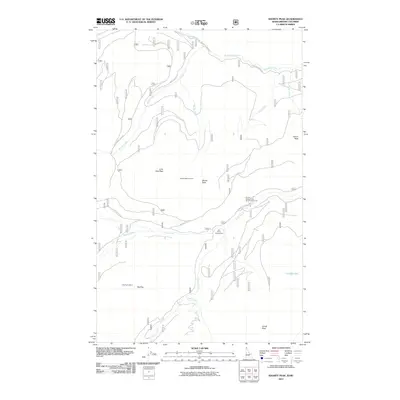
2011 Map of Shorty Peak
USGS Topo · Published 2011About this map
Shorty Peak Lookout and Red Top Lookout crown the high ridges of this international borderland, marking a landscape defined by forestry management and high-altitude topography. The map illustrates the specialized infrastructure of the U.S. Forest Service during the early 21st century, including the United States Forest Service Camp 216 and the Dirt Oven Campground. This rugged terrain is bisected by the international boundary between Idaho and British Columbia, with drainage networks like Boundary Creek and Smith Creek carving through the peaks.
Find a feature on this map
22 named features on this map. Tap any name to fly to it.
Don’t see what you’re looking for? This feature index may not catch every label — zoom into the map to look around manually.
Map Details
Editions of this 2011 Shorty Peak Map
This is the sole edition of this map. No revisions or reprints were ever made.
Other maps of this area

1911 · Priest Lake
USGS Topo · 1:250,000

1913 · Priest Lake
USGS Topo · 1:250,000

1958 · Sandpoint
USGS Topo · 1:250,000

1963 · Sandpoint
USGS Topo · 1:250,000

1968 · Smith Falls
USGS Topo · 1:24,000

1969 · Grass Mountain
USGS Topo · 1:24,000
1969 · Caribou Creek
USGS Topo · 1:24,000

1969 · Pyramid Peak
USGS Topo · 1:24,000
1969 · Shorty Peak
USGS Topo · 1:24,000
1969 · Smith Peak
USGS Topo · 1:24,000