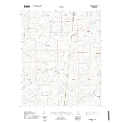
2018 Map of Shottsville
USGS Topo · Published 2018About this map
Shottsville and Tremont sit at the southern margins of a landscape defined by the intersection of state and county lines. This survey documents the boundary between Itawamba County, Mississippi, and Marion and Franklin Counties in Alabama, where State Line Rd NE traces the precise division between the two states. The settlement pattern is characterized by small crossroads communities and family-named landmarks connected by a dense network of country roads like Cotton Gin Rd and Mt Gilead Rd.
Find a feature on this map
79 named features on this map. Tap any name to fly to it.
Don’t see what you’re looking for? This feature index may not catch every label — zoom into the map to look around manually.
Map Details
Editions of this 2018 Shottsville Map
This is the sole edition of this map. No revisions or reprints were ever made.
Other maps of this area

1936 · Red Bay
USGS Topo · 1:24,000

1936 · Vina
USGS Topo · 1:24,000

1936 · Halltown
USGS Topo · 1:24,000

1950 · Vina
USGS Topo · 1:24,000
1950 · Halltown
USGS Topo · 1:24,000

1951 · Vina
USGS Topo · 1:24,000

1951 · Red Bay
USGS Topo · 1:24,000
1951 · Halltown
USGS Topo · 1:24,000

1956 · Tupelo
USGS Topo · 1:250,000

1958 · Tupelo
USGS Topo · 1:250,000