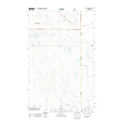
2013 Map of Shovel Lake
USGS Topo · Published 2013About this map
Chippewa National Forest spans the northern reaches of this Aitkin and Cass County borderland, where a dense network of glacial lakes and slow-moving water dominates the landscape. The Willow River meanders through the northern section, joined by Foley Brook and McCrackron Brook, while the southern portion is defined by the Moose River and the expansive Cedar Lake. This is a sparsely populated region of Minnesota, characterized by small-scale road developments like S Little Thunder Dr NE and Canyon Trail Rd. The small community of Shovel Lake sits on the eastern edge of the quadrangle, serving as a landmark near the lake of the same name. Local history is anchored by the Lakeview Cem near Windy Lake, providing a specific point of interest for genealogists researching family ties in this watery timberland.
Find a feature on this map
30 named features on this map. Tap any name to fly to it.
Don’t see what you’re looking for? This feature index may not catch every label — zoom into the map to look around manually.
Map Details
Editions of this 2013 Shovel Lake Map
This is the sole edition of this map. No revisions or reprints were ever made.
Other maps of this area

1953 · Duluth
USGS Topo · 1:250,000

1954 · Hibbing
USGS Topo · 1:250,000

1957 · Hibbing
USGS Topo · 1:250,000

1958 · Hibbing
USGS Topo · 1:250,000

1958 · Duluth
USGS Topo · 1:250,000

1964 · Hibbing
USGS Topo · 1:250,000

1970 · Edna Lake
USGS Topo · 1:24,000

1970 · Big Thunder Peak
USGS Topo · 1:24,000

1970 · Shovel Lake
USGS Topo · 1:24,000
1970 · Roosevelt Lake
USGS Topo · 1:24,000