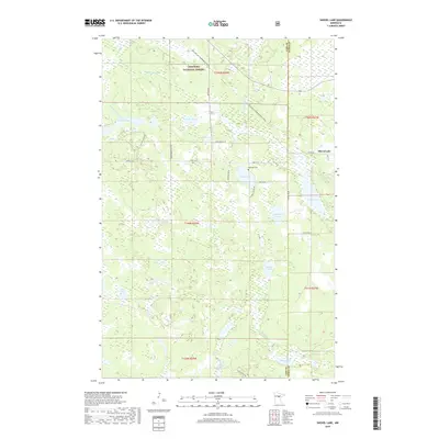
2019 Map of Shovel Lake
USGS Topo · Published 2019About this map
Chippewa National Forest encompasses the northern reaches of this landscape, where the Willow River meanders through a dense network of wetlands and glacial lakes. The small settlement of Shovel Lake sits on the eastern edge of its namesake water body, connected to the surrounding woods by Co Rd 67 and Co Hwy 20. The map reveals a land defined by water and recreational access, with the Soo Line Gia Snowmobile Trail cutting a straight diagonal across the northern townships, following a former rail corridor.
Find a feature on this map
40 named features on this map. Tap any name to fly to it.
Don’t see what you’re looking for? This feature index may not catch every label — zoom into the map to look around manually.
Map Details
Editions of this 2019 Shovel Lake Map
This is the sole edition of this map. No revisions or reprints were ever made.
Other maps of this area

1953 · Duluth
USGS Topo · 1:250,000

1954 · Hibbing
USGS Topo · 1:250,000

1957 · Hibbing
USGS Topo · 1:250,000

1958 · Hibbing
USGS Topo · 1:250,000

1958 · Duluth
USGS Topo · 1:250,000

1964 · Hibbing
USGS Topo · 1:250,000

1970 · Edna Lake
USGS Topo · 1:24,000

1970 · Big Thunder Peak
USGS Topo · 1:24,000

1970 · Shovel Lake
USGS Topo · 1:24,000
1970 · Roosevelt Lake
USGS Topo · 1:24,000