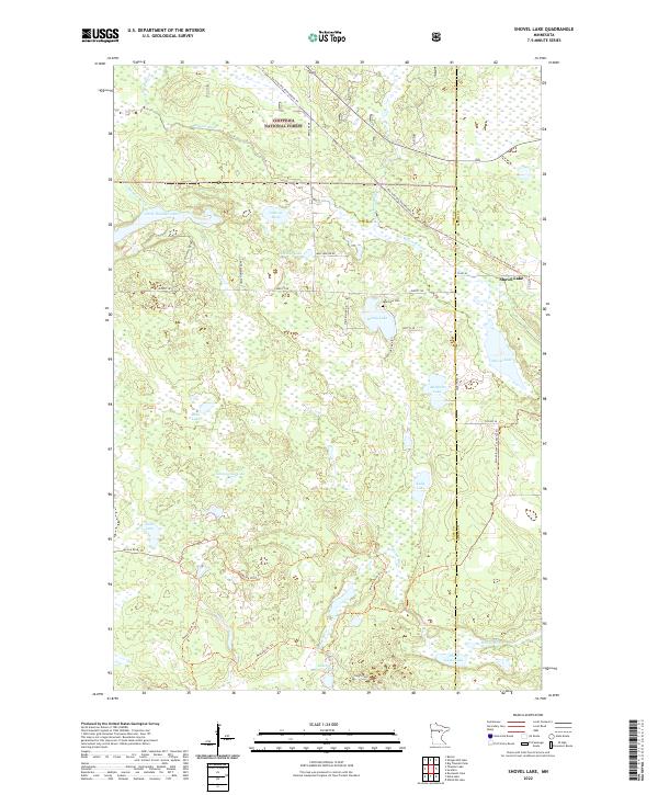
2022 Map of Shovel Lake
USGS Topo · Published 2022About this map
Chippewa National Forest defines the wooded landscape of this northern Minnesota region, where the Willow River and Moose River snake through a complex network of wetlands and glacial lakes. The settlement of Shovel Lake sits near the eastern boundary, situated among several water bodies including Windy Lake, Ahsebun Lake, and the namesake Shovel Lake. The mapping reflects a landscape utilized for recreation and conservation, marked by the conversion of former rail corridors into the Soo Line Gta Snowmobile Trl and Soo Line North: Aitkin Trl. Local history is anchored by the Lakeview Cem and several family or descriptively named landmarks such as Hawk Homestead Trl, Whiskey Lake, and Buck Lake. The road network is sparse, primarily consisting of forest routes and trails like the Moose River Trl, illustrating the area's enduring character as a managed wilderness.
Find a feature on this map
42 named features on this map. Tap any name to fly to it.
Don’t see what you’re looking for? This feature index may not catch every label — zoom into the map to look around manually.
Map Details
Editions of this 2022 Shovel Lake Map
This is the sole edition of this map. No revisions or reprints were ever made.
Other maps of this area

1953 · Duluth
USGS Topo · 1:250,000

1954 · Hibbing
USGS Topo · 1:250,000

1957 · Hibbing
USGS Topo · 1:250,000

1958 · Hibbing
USGS Topo · 1:250,000

1958 · Duluth
USGS Topo · 1:250,000

1964 · Hibbing
USGS Topo · 1:250,000

1970 · Edna Lake
USGS Topo · 1:24,000

1970 · Big Thunder Peak
USGS Topo · 1:24,000

1970 · Shovel Lake
USGS Topo · 1:24,000
1970 · Roosevelt Lake
USGS Topo · 1:24,000