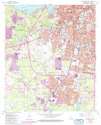
1980 Map of Shreveport West
USGS Topo · Published 1992About this map
The western reaches of Shreveport expand toward the waters of Cross Lake in this detailed look at Caddo Parish during the late twentieth century. This urban-fringe landscape is defined by its extensive rail infrastructure, including the Kansas City Southern RR, Texas and Pacific RR, and Illinois Central RR, which weave through industrial nodes like the Refinery, Tank Farm, and Cut-off Junction. Large-scale civic landmarks anchor the community, from the State Fairground and SPAR Stadium to the sprawling Shreveport Regional Airport. Neighborhood growth is evident around older settlements like Summer Grove and Reisor, supported by an dense network of institutions including St Vincent Academy and numerous public schools. The map preserves the locations of vital community sites such as Star Cem, Hebrew Rest Cem, and the massive Forest Park West Cemetery, making it a primary resource for local historians and genealogists.
Find a feature on this map
116 named features on this map. Tap any name to fly to it.
Don’t see what you’re looking for? This feature index may not catch every label — zoom into the map to look around manually.
Map Details
Editions of this 1980 Shreveport West Map
2 editions found
Other maps of this area

1932 · Bossier SW
USGS Topo · 1:31,680

1932 · Shreveport SE
USGS Topo · 1:31,680

1941 · Forbing
USGS Topo · 1:31,680

1945 · Greenwood
USGS Topo · 1:62,500

1948 · Mooringsport
USGS Topo · 1:62,500

1948 · Bossier City
USGS Topo · 1:62,500

1948 · Caspiana
USGS Topo · 1:62,500

1955 · Shreveport
USGS Topo · 1:250,000
1955 · Bossier City
USGS Topo · 1:24,000

1955 · Shreveport East
USGS Topo · 1:24,000