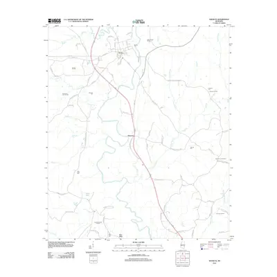
2012 Map of Shubuta
USGS Topo · Published 2012About this map
The Chickasawhay River meanders through this portion of Clarke County, creating a landscape defined by its waterways and energy resources. In the town of Shubuta, a grid of streets like Chestnut St and Mill St centers around the Shubuta Cem, while the surrounding countryside is dotted with family and community burial grounds including Menasco Cem and Atkinson Cem. The local economy is visibly tied to the land, marked by numerous active petroleum sites such as the Shubuta Oil Field, North Yellow Creek Oil Field, and the Chaparral Oil Field. Settlement patterns follow the river and major roads, with the community of Hiwannee situated near the Hiwannee Lookout Tower. Smaller water features like Eucutta Cr and Silver Lake drain into the primary river basin, illustrating the natural drainage of the Pine Belt region.
Find a feature on this map
85 named features on this map. Tap any name to fly to it.
Don’t see what you’re looking for? This feature index may not catch every label — zoom into the map to look around manually.
Map Details
Editions of this 2012 Shubuta Map
This is the sole edition of this map. No revisions or reprints were ever made.
Other maps of this area

1953 · Hattiesburg
USGS Topo · 1:250,000

1958 · Hattiesburg
USGS Topo · 1:250,000

1964 · Carmichael
USGS Topo · 1:24,000

1964 · Denham
USGS Topo · 1:24,000

1964 · Eucutta
USGS Topo · 1:24,000

1964 · Hale
USGS Topo · 1:24,000

1964 · De Soto
USGS Topo · 1:24,000

1964 · Waynesboro
USGS Topo · 1:24,000

1964 · Whistler
USGS Topo · 1:24,000

1964 · Shubuta
USGS Topo · 1:24,000