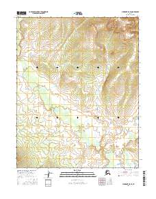
2016 Map of Shungnak A-5 SE
USGS Topo · Published 2016About this map
Interior Alaska's Northwest Arctic and Yukon-Koyukuk regions are defined here by a systematic grid of township and range lines across a vast, unpopulated wilderness. The map focuses on the legal surveying boundaries of T8n R3e and T8n R4e in the north, transitioning to T7n R3e and T7n R4e in the south. This terrain is marked by significant elevation changes, with steep slopes and high-altitude drainage patterns recorded through the high-resolution elevation data of the 2010s. The absence of named settlements or transportation routes emphasizes the isolated nature of this landscape within the Shungnak area, making it a primary reference for public land survey system research and contemporary land management.
Find a feature on this map
4 named features on this map. Tap any name to fly to it.
Don’t see what you’re looking for? This feature index may not catch every label — zoom into the map to look around manually.
Map Details
Editions of this 2016 Shungnak A-5 SE Map
This is the sole edition of this map. No revisions or reprints were ever made.
Other maps of this area

1951 · Shungnak
USGS Topo · 1:250,000

1951 · Kateel River
USGS Topo · 1:250,000

1954 · Kateel River D-4
USGS Topo · 1:63,360

1954 · Kateel River D-5
USGS Topo · 1:63,360

1955 · Shungnak
USGS Topo · 1:250,000

1955 · Kateel River
USGS Topo · 1:250,000

1964 · Shungnak
USGS Topo · 1:250,000
1985 · Shungnak A-5
USGS Topo · 1:63,360
1985 · Shungnak A-4
USGS Topo · 1:63,360
2016 · Shungnak A-5 SW
USGS Topo · 1:25,000