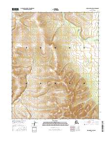
2016 Map of Shungnak A-5 SW
USGS Topo · Published 2016About this map
Uninhabited wilderness in the Yukon-Koyukuk region defines this landscape, where the Public Land Survey System (PLSS) provides the primary structure for navigation and land management. The terrain is organized by the survey boundaries of T8n R2e, T8n R3e, T7n R2e, and T7n R3e, which delineate the townships and ranges of the Alaska interior. This 2016 survey relies on contemporary data sources such as the Alaska Dept. of Transportation and the FWS National Wetlands Inventory to map a territory devoid of modern roads or permanent settlements. The topographic lines and section grids reflect a vast, unpopulated expanse where hydrology and elevation are the defining characteristics of the land, providing a base for researchers and environmental surveyors working in the remote Shungnak A-5 SW quadrangle.
Find a feature on this map
4 named features on this map. Tap any name to fly to it.
Don’t see what you’re looking for? This feature index may not catch every label — zoom into the map to look around manually.
Map Details
Editions of this 2016 Shungnak A-5 SW Map
This is the sole edition of this map. No revisions or reprints were ever made.
Other maps of this area

1951 · Shungnak
USGS Topo · 1:250,000

1951 · Kateel River
USGS Topo · 1:250,000

1954 · Kateel River D-6
USGS Topo · 1:63,360

1954 · Kateel River D-5
USGS Topo · 1:63,360

1955 · Shungnak
USGS Topo · 1:250,000

1955 · Kateel River
USGS Topo · 1:250,000

1964 · Shungnak
USGS Topo · 1:250,000
1985 · Shungnak A-5
USGS Topo · 1:63,360
1985 · Shungnak A-6
USGS Topo · 1:63,360
2015 · Kateel River D-6 NE
USGS Topo · 1:25,000