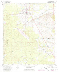
1962 Map of Shuqualak
USGS Topo · Published 1982About this map
Shuqualak serves as the primary hub of this East Mississippi landscape, where the Illinois Central Gulf corridor shapes the local geography. The map documents a significant intersection of civil and military use, notably featuring the Alpha Field Naval Auxiliary Air Station south of the main settlement. The terrain is defined by the drainages of Shuqualak Creek and Wahalak Creek, which bisect the countryside.
Find a feature on this map
22 named features on this map. Tap any name to fly to it.
Don’t see what you’re looking for? This feature index may not catch every label — zoom into the map to look around manually.
Map Details
Editions of this 1962 Shuqualak Map
2 editions found
Other maps of this area

1953 · Meridian
USGS Topo · 1:250,000

1953 · West Point
USGS Topo · 1:250,000

1957 · Meridian
USGS Topo · 1:250,000

1958 · West Point
USGS Topo · 1:250,000

1962 · Shuqualak
USGS Topo · 1:24,000

1963 · West Point
USGS Topo · 1:250,000

1963 · De Kalb
USGS Topo · 1:24,000

1963 · Townsend
USGS Topo · 1:24,000

1963 · Gholson
USGS Topo · 1:24,000

1965 · Meridian
USGS Topo · 1:250,000