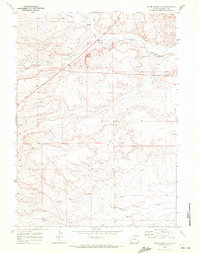
1969 Map of Shute Creek Lake
USGS Topo · Published 1972About this map
The high plains of Lincoln County come into focus in this late-1960s survey, defined by the convergence of historic migration routes and early industrial infrastructure. The path of the Emigrant Trail cuts across the northern landscape, following the contours of the drainage near Slate Creek and Jackson Creek. This corridor of travel, once a lifeline for westward movement, is juxtaposed against the mid-century development of the Pipeline and the Fontenelle Townsite Road. Irrigation and water management are prominent markers of local land use, evidenced by the Graham Ditch and the presence of a Flowing Well and Drill Hole in the basin. To the south, Shute Creek Lake and the meandering Shute Creek provide a rare water source in an otherwise arid expanse, while the small settlement of Fontenelle and nearby Gravel Pit indicate the sparse but steady human footprint in this part of Wyoming.
Find a feature on this map
18 named features on this map. Tap any name to fly to it.
Don’t see what you’re looking for? This feature index may not catch every label — zoom into the map to look around manually.
Map Details
Editions of this 1969 Shute Creek Lake Map
2 editions found
Other maps of this area

1945 · Fort Hill
USGS Topo · 1:62,500

1947 · Fort Hill
USGS Topo · 1:62,500

1954 · Ogden
USGS Topo · 1:250,000

1955 · Preston
USGS Topo · 1:250,000

1958 · Ogden
USGS Topo · 1:250,000

1958 · Preston
USGS Topo · 1:250,000

1960 · Ogden
USGS Topo · 1:250,000

1962 · Preston
USGS Topo · 1:250,000

1968 · Fontenelle Reservoir SE
USGS Topo · 1:24,000

1968 · Fontenelle Reservoir SW
USGS Topo · 1:24,000