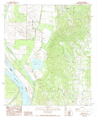
1988 Map of Sibley
USGS Topo · Published 1988About this map
Mississippi River current and floodplain dynamics dominate this landscape south of Natchez, where the St Catherine Creek bends toward the river at Esperance Point. The 1980s terrain is a complex arrangement of active and remnant water bodies, including Butler Lake, Long Willow Lake, and the winding Old Catherine Creek. These features illustrate the shifting hydrology of the Adams County riverfront before more modern control measures.
Find a feature on this map
25 named features on this map. Tap any name to fly to it.
Don’t see what you’re looking for? This feature index may not catch every label — zoom into the map to look around manually.
Map Details
Editions of this 1988 Sibley Map
This is the sole edition of this map. No revisions or reprints were ever made.
Other maps of this area

1909 · Sycamore Landing
USGS Topo · 1:24,000

1909 · Vidalia
USGS Topo · 1:24,000

1921 · Natchez
USGS Topo · 1:48,000

1922 · Natchez
USGS Topo · 1:62,500

1939 · Red Gum
USGS Topo · 1:62,500

1939 · Natchez
USGS Topo · 1:62,500

1939 · Kingston
USGS Topo · 1:62,500

1939 · Deer Park
USGS Topo · 1:62,500

1953 · Natchez
USGS Topo · 1:250,000

1956 · Natchez
USGS Topo · 1:250,000