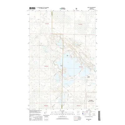
2016 Map of Side Lake
USGS Topo · Published 2016About this map
Side Lake and the interconnected waters of the Sturgeon chain anchor this landscape on the border of Itasca and St. Louis counties. The settlement of Side Lake serves as the focal point for a complex network of seasonal and residential roads, including McCarthy Beach Rd and Watson Bay Rd, which trace the irregular shorelines of W Sturgeon Lake and Little Sturgeon Lake. To the south, the boundary of the Superior National Forest encompasses Shanon Lake, marking a transition into protected timberlands.
Find a feature on this map
66 named features on this map. Tap any name to fly to it.
Don’t see what you’re looking for? This feature index may not catch every label — zoom into the map to look around manually.
Map Details
Editions of this 2016 Side Lake Map
This is the sole edition of this map. No revisions or reprints were ever made.
Other maps of this area

1954 · Hibbing
USGS Topo · 1:250,000

1955 · Dewey Lake NW
USGS Topo · 1:24,000

1955 · Dewey Lake
USGS Topo · 1:24,000

1957 · Hibbing
USGS Topo · 1:250,000

1958 · Hibbing
USGS Topo · 1:250,000

1964 · Hibbing
USGS Topo · 1:250,000

1964 · Side Lake
USGS Topo · 1:24,000
1964 · Stingy Lake
USGS Topo · 1:24,000
1964 · Meadow Brook
USGS Topo · 1:24,000

1964 · Sherry Lake
USGS Topo · 1:24,000