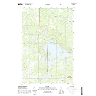
2019 Map of Side Lake
USGS Topo · Published 2019About this map
Side Lake serves as the focal point for this northern Minnesota landscape, where the waters of the Sturgeon River connect a complex chain of lakes including West Sturgeon Lake, Little Sturgeon Lake, and South Sturgeon Lake. The area is characterized by a dense network of water bodies and islands, notably Barrett Island and Hayes Island, which dominate the central hydrology. A portion of the Superior National Forest covers the southeastern corner, reflecting the timber and conservation heritage of the region.
Find a feature on this map
63 named features on this map. Tap any name to fly to it.
Don’t see what you’re looking for? This feature index may not catch every label — zoom into the map to look around manually.
Map Details
Editions of this 2019 Side Lake Map
This is the sole edition of this map. No revisions or reprints were ever made.
Other maps of this area

1954 · Hibbing
USGS Topo · 1:250,000

1955 · Dewey Lake NW
USGS Topo · 1:24,000

1955 · Dewey Lake
USGS Topo · 1:24,000

1957 · Hibbing
USGS Topo · 1:250,000

1958 · Hibbing
USGS Topo · 1:250,000

1964 · Hibbing
USGS Topo · 1:250,000

1964 · Side Lake
USGS Topo · 1:24,000
1964 · Stingy Lake
USGS Topo · 1:24,000
1964 · Meadow Brook
USGS Topo · 1:24,000

1964 · Sherry Lake
USGS Topo · 1:24,000