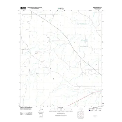
2012 Map of Sidney
USGS Topo · Published 2012About this map
Sidney serves as the central hub for this rural Comanche County landscape, situated at the junction of Ranch Road 1689 and several local county routes. The topography is defined by the modest elevations of Round Mtn and Long Mtn, which rise above a network of waterways including Sweetwater Cr, Jimmys Cr, and Duncan Cr. This 2012 survey illustrates a land management system dominated by ranching and soil conservation, evidenced by the Soil Conservation Service Site 13 Reservoir and Soil Conservation Service Site 14 Reservoir. For those researching local family histories, the map identifies three distinct burial grounds: Suggs Cem in the north, Pendergrass Cem near the town site, and Ferrill Cem further south, providing specific geographic points for genealogical study.
Find a feature on this map
40 named features on this map. Tap any name to fly to it.
Don’t see what you’re looking for? This feature index may not catch every label — zoom into the map to look around manually.
Map Details
Editions of this 2012 Sidney Map
This is the sole edition of this map. No revisions or reprints were ever made.
Other maps of this area

1889 · Brownwood
USGS Topo · 1:125,000

1894 · Eastland
USGS Topo · 1:125,000

1894 · Brownwood
USGS Topo · 1:125,000

1954 · Brownwood
USGS Topo · 1:250,000

1954 · Abilene
USGS Topo · 1:250,000

1958 · Abilene
USGS Topo · 1:250,000

1966 · Star Mountain
USGS Topo · 1:24,000

1966 · Sipe Springs
USGS Topo · 1:24,000
1966 · Blanket
USGS Topo · 1:24,000
1969 · Duster
USGS Topo · 1:24,000