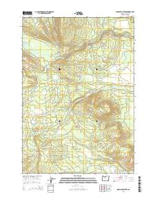
2014 Map of Sidwalter Buttes
USGS Topo · Published 2014About this map
Warm Springs River and its southern fork carve through this high-elevation landscape in the early 21st century, defining the drainage patterns of the eastern Cascades. The topography is anchored by the prominent Sidwalter Buttes and the broad expanse of Mill Creek Flat to the southeast. Remote access to this area is maintained through a complex network of Bureau of Indian Affairs (BIA) and forest roads, including the Schoolie-Mt Wilson Rd and Camas Prairie Rd, which hint at long-standing land management and livestock grazing practices in locations like Schoolie Pasture. Water resources are vital in this terrain, as evidenced by the distribution of named points like Big Spring and Nellie Spring, alongside the Mill Cr Lateral canal. The map provides a clear look at the survey boundaries and the intersections of Township and Range lines that organize this portion of Wasco County.
Find a feature on this map
44 named features on this map. Tap any name to fly to it.
Don’t see what you’re looking for? This feature index may not catch every label — zoom into the map to look around manually.
Map Details
Editions of this 2014 Sidwalter Buttes Map
This is the sole edition of this map. No revisions or reprints were ever made.
Other maps of this area

1924 · Mount Hood
USGS Topo · 1:125,000

1927 · Mount Hood
USGS Topo · 1:125,000

1927 · Mt. Jefferson
USGS Topo · 1:125,000

1928 · Madras
USGS Topo · 1:125,000

1930 · Mt. Jefferson
USGS Topo · 1:125,000

1930 · Dufur
USGS Topo · 1:125,000

1931 · Madras
USGS Topo · 1:125,000

1934 · Dufur
USGS Topo · 1:125,000

1953 · The Dalles
USGS Topo · 1:250,000

1955 · Bend
USGS Topo · 1:250,000