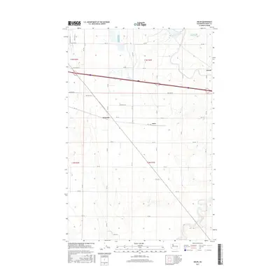
2017 Map of Sieler
USGS Topo · Published 2017About this map
Agricultural irrigation systems and the logistics of the modern Columbia Basin Project define this 2017 survey of the Washington desert. Sieler, Atwood, and McDonald appear as localized points of interest amidst a strict grid of county roads and water infrastructure. The prominent Canal cutting across the northern half of the landscape represents the region's total transformation through large-scale engineering, while the Carnation Waste Pond indicates the industrial-scale food processing that supports the local economy. Grounded in the late-20th-century development of Grant County, the map follows the interplay between transportation and utility, featuring the diagonal path of Potato Frontage Rd SE as it deviates from the standard township grid to service regional transport corridors.
Find a feature on this map
41 named features on this map. Tap any name to fly to it.
Don’t see what you’re looking for? This feature index may not catch every label — zoom into the map to look around manually.
Map Details
Editions of this 2017 Sieler Map
This is the sole edition of this map. No revisions or reprints were ever made.
Other maps of this area

1912 · Moses Lake
USGS Topo · 1:62,500

1923 · Corfu
USGS Topo · 1:62,500

1923 · Wheeler
USGS Topo · 1:62,500

1924 · Othello
USGS Topo · 1:62,500

1925 · Wheeler
USGS Topo · 1:62,500

1951 · Corfu
USGS Topo · 1:62,500

1953 · Walla Walla
USGS Topo · 1:250,000

1953 · Ritzville
USGS Topo · 1:250,000

1954 · Warden
USGS Topo · 1:24,000

1954 · Soda Lake
USGS Topo · 1:24,000