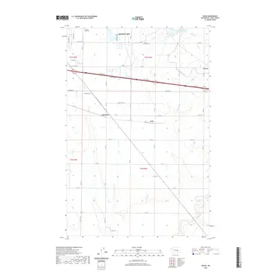
2020 Map of Sieler
USGS Topo · Published 2020About this map
Pioneer Memorial Cem and Guarding Angels Cem sit within the high desert landscape of Grant County, marking the heritage of early agricultural efforts in this arid region of Washington. The area's development is closely tied to the irrigation network, evidenced by the Canal and East Low Canal that cut through the terrain. Small rural clusters like McDonald, Sieler, and Atwood are situated along a grid of section-line roads, many of which bear local family or descriptive names such as Nelson Rd NE and Potato Frontage Rd SE. Near the northern boundary, the waters of Moses Lake influence the local topography, while industrial land use appears through features like Carnation Waste Pond Number Six. This landscape reflects the transition from early settlement to modern large-scale irrigation and agriculture.
Find a feature on this map
45 named features on this map. Tap any name to fly to it.
Don’t see what you’re looking for? This feature index may not catch every label — zoom into the map to look around manually.
Map Details
Editions of this 2020 Sieler Map
This is the sole edition of this map. No revisions or reprints were ever made.
Other maps of this area

1912 · Moses Lake
USGS Topo · 1:62,500

1923 · Corfu
USGS Topo · 1:62,500

1923 · Wheeler
USGS Topo · 1:62,500

1924 · Othello
USGS Topo · 1:62,500

1925 · Wheeler
USGS Topo · 1:62,500

1951 · Corfu
USGS Topo · 1:62,500

1953 · Walla Walla
USGS Topo · 1:250,000

1953 · Ritzville
USGS Topo · 1:250,000

1954 · Warden
USGS Topo · 1:24,000

1954 · Soda Lake
USGS Topo · 1:24,000