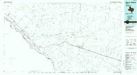
1985 Map of Sierra Blanca
USGS Topo · Published 1985About this map
The Rio Grande corridor and the high desert of Hudspeth County define this mid-1980s landscape, where international boundaries and mountain ranges meet. Along the river, settlements like Fort Hancock and Acala sit adjacent to the United States-Mexico border, while the interior is dominated by the Quitman Mountains and the Finlay Mountains. The map marks the Fort Quitman (Site) near the river, a location significant for its role in the 19th-century frontier defense system.
Find a feature on this map
68 named features on this map. Tap any name to fly to it.
Don’t see what you’re looking for? This feature index may not catch every label — zoom into the map to look around manually.
Map Details
Editions of this 1985 Sierra Blanca Map
2 editions found
Other maps of this area

1892 · Chispa
USGS Topo · 1:125,000

1894 · Fort Hancock
USGS Topo · 1:125,000

1895 · Chispa
USGS Topo · 1:125,000

1895 · Sierra Blanca
USGS Topo · 1:125,000

1896 · El Paso
USGS Topo · 1:125,000

1896 · Rio Grande
USGS Topo · 1:125,000

1897 · Eagle Mountain
USGS Topo · 1:125,000

1897 · Chispa
USGS Topo · 1:125,000

1903 · Cerro Alto
USGS Topo · 1:125,000

1906 · Van Horn
USGS Topo · 1:125,000