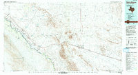
1985 Map of Sierra Blanca
USGS Topo · Published 1993About this map
The Rio Grande serves as a stark international boundary on this mid-1980s landscape, separating the United States of America from Estados Unidos Mexicanos. The map documents a rugged West Texas corridor where the Southern Pacific Railroad and regional highways parallel the river's course, connecting border settlements like Fort Hancock, Mc Nary, and Esperanza. This transportation spine is hemmed in by massive geological features, most notably the Quitman Mountains and the distinct volcanic peak of Sierra Blanca.
Find a feature on this map
38 named features on this map. Tap any name to fly to it.
Don’t see what you’re looking for? This feature index may not catch every label — zoom into the map to look around manually.
Map Details
Editions of this 1985 Sierra Blanca Map
2 editions found
Other maps of this area

1892 · Chispa
USGS Topo · 1:125,000

1894 · Fort Hancock
USGS Topo · 1:125,000

1895 · Chispa
USGS Topo · 1:125,000

1895 · Sierra Blanca
USGS Topo · 1:125,000

1896 · El Paso
USGS Topo · 1:125,000

1896 · Rio Grande
USGS Topo · 1:125,000

1897 · Eagle Mountain
USGS Topo · 1:125,000

1897 · Chispa
USGS Topo · 1:125,000

1903 · Cerro Alto
USGS Topo · 1:125,000

1906 · Van Horn
USGS Topo · 1:125,000