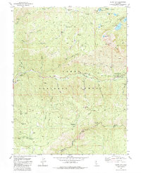
1981 Map of Sierra City
USGS Topo · Published 1984About this map
Sierra City and the neighboring settlement of Loganville sit at the center of this 1981 study of the northern Sierra Nevada. The landscape is defined by its deep mining heritage, with dozens of active and historic workings such as the Sierra Buttes Mine, Keystone Mine, and Monarch Mine dotting the terrain below the Sierra Buttes. This era of documentation shows the transition of the region from an industrial mining hub into a recreational landscape within the Tahoe National Forest, evidenced by the presence of the Pacific Crest National Scenic Trail and numerous campgrounds.
Find a feature on this map
72 named features on this map. Tap any name to fly to it.
Don’t see what you’re looking for? This feature index may not catch every label — zoom into the map to look around manually.
Map Details
Editions of this 1981 Sierra City Map
2 editions found
Other maps of this area

1891 · Downieville
USGS Topo · 1:125,000

1891 · Colfax
USGS Topo · 1:125,000

1892 · Colfax
USGS Topo · 1:125,000

1893 · Downieville
USGS Topo · 1:125,000

1894 · Colfax
USGS Topo · 1:125,000

1895 · Downieville
USGS Topo · 1:125,000

1896 · Downieville
USGS Topo · 1:125,000

1897 · Downieville
USGS Topo · 1:125,000

1898 · Colfax
USGS Topo · 1:125,000

1900 · Colfax
USGS Topo · 1:125,000