
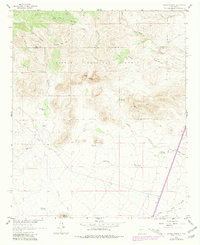
1961 Map of Sierra Fijardo
USGS Topo · Published 1963About this map
Cibola National Forest encompasses the high desert terrain of this region, where steep ridges and deep arroyos define the movement of water and livestock. The map highlights the rugged topography of the Sierra Fijardo and Sierras Mediano, punctuated by locally named landmarks like Whiskey Hill, Eagles Roost, and Rattlesnake Hill. Human activity in the early 1960s was centered on ranching and resource extraction, evidenced by the Flying X Ranch, a Gravel Pit, and the H Bierner No 2 Res.
Find a feature on this map
28 named features on this map. Tap any name to fly to it.
Don’t see what you’re looking for? This feature index may not catch every label — zoom into the map to look around manually.
Map Details
Editions of this 1961 Sierra Fijardo Map
2 editions found
Other maps of this area

1954 · Tularosa
USGS Topo · 1:250,000

1958 · Tularosa
USGS Topo · 1:250,000

1961 · Priest Tank
USGS Topo · 1:24,000

1961 · Huerfano Hill
USGS Topo · 1:24,000

1961 · Black Bluffs
USGS Topo · 1:24,000

1961 · Black Hill
USGS Topo · 1:24,000

1961 · Monticello
USGS Topo · 1:24,000

1961 · Romero Canyon
USGS Topo · 1:24,000

1964 · Vicks Peak
USGS Topo · 1:24,000

1964 · Steel Hill
USGS Topo · 1:24,000