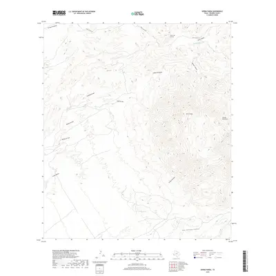
2019 Map of Sierra Parda
USGS Topo · Published 2019About this map
Sierra Parda and the western reaches of the Chinati Mountains dominate this Presidio County landscape, where deep drainages and isolated springs define the remote terrain. The northern territory is bisected by Pinto Canyon Rd, which skirts the base of Cerro de la Cruz and crosses the upper Pinto Canyon. Water sources are critical landmarks in this arid environment, represented by the Indian Spring and the high-elevation seeps at Ojo Acebuche and Ojo Alamito. A complex network of arroyos, including Arroyo Escondido and Arroyo Cienega, illustrates how seasonal runoff has carved the earth over millennia, feeding into major topographical features like the San Antonio Canyon at the southern edge of the survey area. This data, compiled from recent aerial imagery and elevation models, provides an exact record of natural landmarks and primitive transit corridors in the Big Bend region.
Find a feature on this map
18 named features on this map. Tap any name to fly to it.
Don’t see what you’re looking for? This feature index may not catch every label — zoom into the map to look around manually.
Map Details
Editions of this 2019 Sierra Parda Map
This is the sole edition of this map. No revisions or reprints were ever made.
Other maps of this area

1895 · Marfa
USGS Topo · 1:125,000

1896 · Ruidosa
USGS Topo · 1:125,000

1896 · San Carlos
USGS Topo · 1:125,000

1896 · Shafter
USGS Topo · 1:125,000

1959 · Presidio
USGS Topo · 1:250,000

1959 · Marfa
USGS Topo · 1:250,000

1965 · Presidio
USGS Topo · 1:250,000

1965 · Marfa
USGS Topo · 1:250,000

1966 · Adobes
USGS Topo · 1:24,000

1978 · Sierra Parda
USGS Topo · 1:24,000