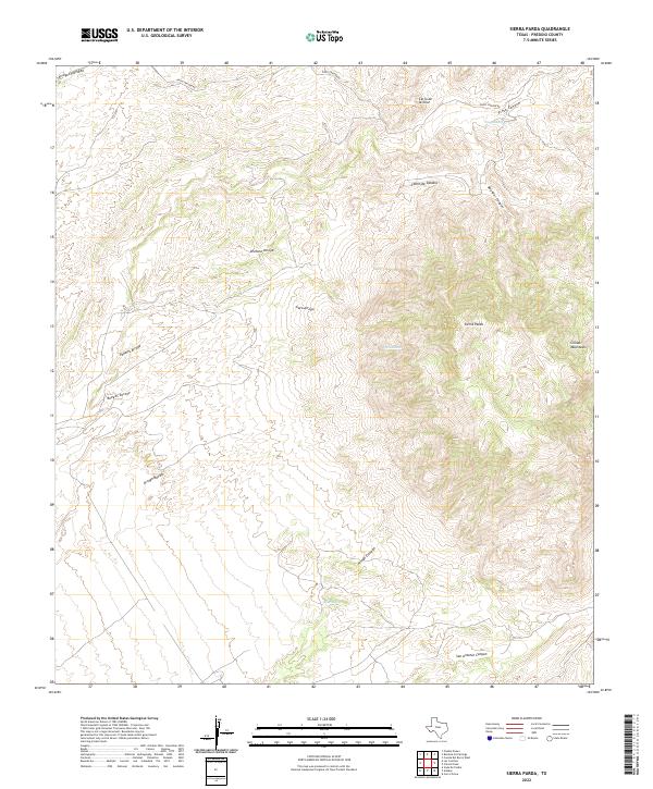
2022 Map of Sierra Parda
USGS Topo · Published 2022About this map
Sierra Parda rises as a central prominence within this arid stretch of West Texas, flanked by the eastern reaches of the Chinati Mountains. The landscape is defined by a dense network of drainage systems, with the Pinto Canyon Rd providing one of the few managed routes through the complex topography. Arroyos such as Arenoso Arroyo and Gato Arroyo carve through the basin floor, while named springs like Indian Spring and Ojo Alamito suggest vital water sources in an otherwise parched environment.
Find a feature on this map
18 named features on this map. Tap any name to fly to it.
Don’t see what you’re looking for? This feature index may not catch every label — zoom into the map to look around manually.
Map Details
Editions of this 2022 Sierra Parda Map
This is the sole edition of this map. No revisions or reprints were ever made.
Other maps of this area

1895 · Marfa
USGS Topo · 1:125,000

1896 · Ruidosa
USGS Topo · 1:125,000

1896 · San Carlos
USGS Topo · 1:125,000

1896 · Shafter
USGS Topo · 1:125,000

1959 · Presidio
USGS Topo · 1:250,000

1959 · Marfa
USGS Topo · 1:250,000

1965 · Presidio
USGS Topo · 1:250,000

1965 · Marfa
USGS Topo · 1:250,000

1966 · Adobes
USGS Topo · 1:24,000

1978 · Sierra Parda
USGS Topo · 1:24,000