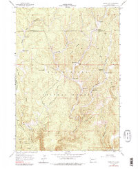
1955 Map of Signal Hill
USGS Topo · Published 1979About this map
Black Hills National Forest land dominates this 1955 survey of the southwestern Black Hills, where the high-altitude landscape is defined by deep drainages and ranching outposts. The topographic detail reveals a network of canyons, most notably Hell Canyon and its tributaries, West Hell Canyon and Fork Hell Canyon. Higher elevations are marked by the Signal Hill Lookout Tower, which provides a vantage point over the complex terrain of Elliot Ridge and Antelope Ridge.
Find a feature on this map
31 named features on this map. Tap any name to fly to it.
Don’t see what you’re looking for? This feature index may not catch every label — zoom into the map to look around manually.
Map Details
Editions of this 1955 Signal Hill Map
4 editions found
Other maps of this area

1896 · Harney Peak
USGS Topo · 1:125,000

1901 · Harney Peak
USGS Topo · 1:125,000

1954 · Fourmile
USGS Topo · 1:24,000

1954 · Berne
USGS Topo · 1:24,000

1955 · Dead Horse Flats
USGS Topo · 1:24,000

1955 · Jewel Cave NW
USGS Topo · 1:24,000

1955 · Jewel Cave
USGS Topo · 1:24,000

1955 · Signal Hill
USGS Topo · 1:24,000

1955 · Hot Springs
USGS Topo · 1:250,000
1956 · Custer
USGS Topo · 1:62,500