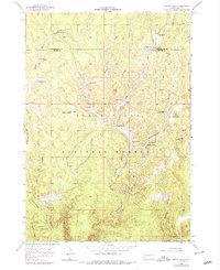
1955 Map of Signal Hill
USGS Topo · Published 1979About this map
Black Hills National Forest land dominates this mid-century survey, revealing a landscape defined by ranching and resource extraction along the border of Pennington and Custer counties. The distribution of family-named holdings like Doll Ranch and Sturm Ranch indicates a settlement pattern tied to the limited water sources of the high plains, such as Alkali Spring and Bull Spring.
Find a feature on this map
29 named features on this map. Tap any name to fly to it.
Don’t see what you’re looking for? This feature index may not catch every label — zoom into the map to look around manually.
Map Details
Editions of this 1955 Signal Hill Map
4 editions found
Other maps of this area

1896 · Harney Peak
USGS Topo · 1:125,000

1901 · Harney Peak
USGS Topo · 1:125,000

1954 · Fourmile
USGS Topo · 1:24,000

1954 · Berne
USGS Topo · 1:24,000

1955 · Dead Horse Flats
USGS Topo · 1:24,000

1955 · Jewel Cave NW
USGS Topo · 1:24,000

1955 · Jewel Cave
USGS Topo · 1:24,000

1955 · Signal Hill
USGS Topo · 1:24,000

1955 · Hot Springs
USGS Topo · 1:250,000
1956 · Custer
USGS Topo · 1:62,500