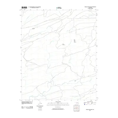
2010 Map of Signal Mountain
USGS Topo · Published 2010About this map
Signal Mountain Lookout Tower stands as a focal point in this portion of the Ouachita National Forest region, marking the high ground between complex drainage systems. The landscape is defined by the sharp rise of John Noah Mountain and the prominent East Signal Peak Signal Mountain, which overlook a network of logging and access paths. These routes, including Harry Rowe Trl and the uniquely named Round Mountain Trl Dead End Trl, provide passage through a terrain cut by numerous watercourses. The hydrology of the area is particularly intricate, with Whisky Branch, Houston Creek, and multiple branches of Terrapin Creek carving through the slopes. Local land use is noted by the presence of Brannon Ranch, while the northern reaches are accessed via Holly Creek Rd, illustrating the intersection of remote forest management and private ranching interests in McCurtain County.
Find a feature on this map
21 named features on this map. Tap any name to fly to it.
Don’t see what you’re looking for? This feature index may not catch every label — zoom into the map to look around manually.
Map Details
Editions of this 2010 Signal Mountain Map
This is the sole edition of this map. No revisions or reprints were ever made.
Other maps of this area

1901 · Alikchi
USGS Topo · 1:125,000

1902 · Lukfata
USGS Topo · 1:125,000

1950 · Mcalester
USGS Topo · 1:250,000

1959 · Golden
USGS Topo · 1:62,500

1960 · Bethel
USGS Topo · 1:62,500

1962 · McAlester
USGS Topo · 1:250,000

1962 · Sobol
USGS Topo · 1:24,000

1962 · Caney Mountain
USGS Topo · 1:24,000

1962 · Alikchi
USGS Topo · 1:24,000

1962 · Signal Mountain
USGS Topo · 1:24,000