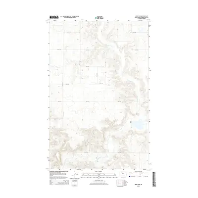
2014 Map of Sikes Dam
USGS Topo · Published 2014About this map
Little Knife River meanders through the heart of this Mountrail County landscape, cutting a deep drainage across the prairie of northwestern North Dakota. The river's path is the defining topographic feature, eventually reaching the reservoir created by Sikes Dam in the southeast portion of the quadrangle. The terrain here reflects the High Plains character, where the elevation changes are concentrated primarily along the river bluffs and coulees.
Find a feature on this map
13 named features on this map. Tap any name to fly to it.
Don’t see what you’re looking for? This feature index may not catch every label — zoom into the map to look around manually.
Map Details
Editions of this 2014 Sikes Dam Map
This is the sole edition of this map. No revisions or reprints were ever made.
Other maps of this area

1953 · Williston
USGS Topo · 1:250,000

1957 · Williston
USGS Topo · 1:250,000

1969 · Stanley
USGS Topo · 1:24,000

1969 · Stanley SE
USGS Topo · 1:24,000

1981 · Belden SW
USGS Topo · 1:24,000

1981 · Robinson Lake
USGS Topo · 1:24,000
1981 · Rat Lake SE
USGS Topo · 1:24,000
1981 · Belden SE
USGS Topo · 1:24,000

1981 · Ross
USGS Topo · 1:24,000

1981 · Stanley SE
USGS Topo · 1:24,000